 
| Subject: | |
| From: | |
| Reply To: | Maps, Air Photo, GIS Forum - Map Librarianship |
| Date: | Mon, 20 May 2013 15:55:22 -0500 |
| Content-Type: | multipart/mixed |
| Parts/Attachments: |
|
|
Two jpegs attached. Contact Jennifer if you have difficulty viewing them.
-------- Original Message --------
Subject: A map of a different color...
Date: Mon, 20 May 2013 20:19:50 +0000
From: Farrington,Jennifer J <[log in to unmask]>
To: [log in to unmask] <[log in to unmask]>
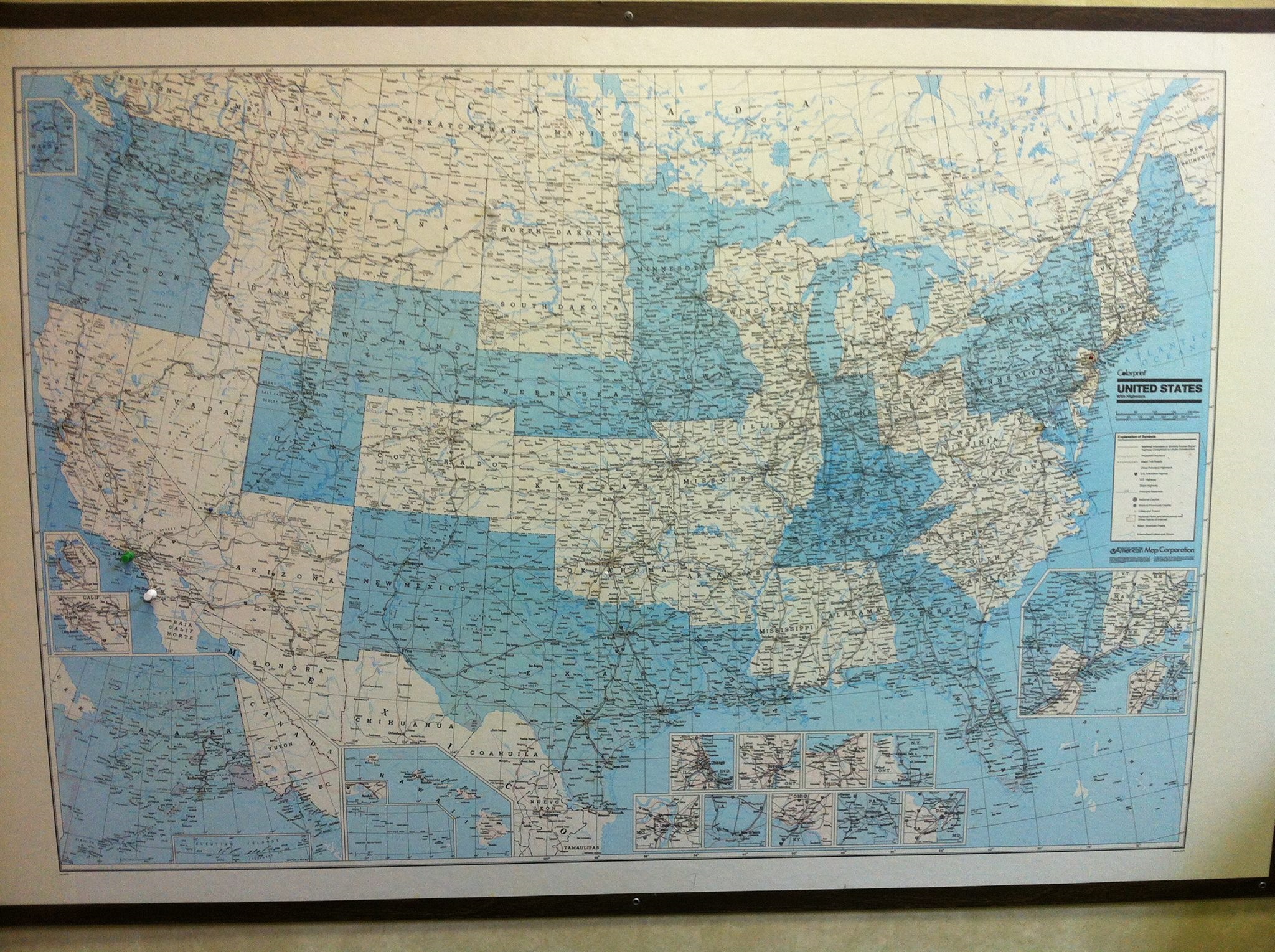
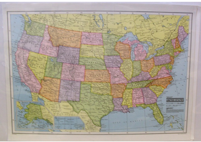
A patron has asked what the blue color (see" BlueVersion" attachment)
means in his version of this map:
Author, etc.: American Map Corporation
Title: United States with highways
American Map Corporation.
Scale: Scale [ca. 1:4,000,000] (W 126°--W 66°/N
50°--N 24°).
Published: [New York] : American Map Corporation, c1986.
Description: 1 map : col., plastic coated ; 82 x 121 cm.
Alternate title: Colorprint United States with highways.
Notes: Includes insets of Alaska, Hawaii, and 14
major metropolitan areas.
At head of title: Colorprint.
"Map No. 9578."
Subjects, general: Roads -- United States -- Maps
United States -- Maps
Subjects,geog(maps): Roads -- United States -- 1986 -- 1:4,000,000 -- FU
United States -- 1986 -- 1:4,000,000 -- FU
United States -- Roads -- 1986 --
1:4,000,000 -- FU
Format: Map
OCLC: 15307837
The map in our collection is colored similarly to the "ColorVersion"
example (this is an example to show coloring only, and is not the map in
question). The map I have in hand and the patron's map both have a 1986
copyright and have "Map No. 9578" in the lower right-hand corner. They
appear to be the same in most every way except color. Any ideas on what
the blue represents in my patron's map?
Thank you,
Jennifer Farrington
Senior Archivist
Map & Imagery Library
University of Florida
(352) 273-2825
|
|
|


