-------- Original Message --------
Subject: Re: Fw: Map or satellite image of Victoria Land, Antarctica
needed
Date: Wed, 28 Oct 2009 16:20:01 -0400
From: Daniel R Sechrist <[log in to unmask]>
To: maps-l
CC:
References:
*Francis Herbert,*
*Fortunately, one of the best source for current, post 2005, satellite
imagery of Mount Swinford, Ringer Glacier, or the entire continent of
Antarctica is the Landsat Image Mosaic of Antarctica (LIMA). As the
name implies, LIMA is comprised of over 1,000 Landsat ETM+ scenes that
were color corrected and edge-matched to create a seamless image to
cover the continent. The combined image was then sub-divided into tiles
to facilitate easy downloading of specific areas for study.*
*Below is a link to the LIMA web site where you can learn more about the
data and download the tile that covers your area of interest:*
*http://lima.usgs.gov/*
*From there click on the link "Download Mosaics and Landsat Scenes" to
go to the page showing the tiling scheme. It will become apparent that
the tile you need is named "x+0300000y-1350000". By clicking on the
appropriate tile you will be prompted to download a file. This file
will be somewhat large and will be in ZIP format, meaning you will need
a program like "WinZIP" or "PKZip" to decompress and extract the image.*
*Inside this zipped file are several compressed files including a
read-me file, several files called a "shape-file", an HTML file that
describes the data, the image in both geo-JPG and geo-TIF format along
with "world files" that tie the image to real world map projected
coordinates.*
*If you are familiar with Geographic Information Systems (GIS) most of
these files should be familiar to you. If not, the JPG and TIF images
may be all you need. These images can be opened with many image editing
software packages like Adobe Photoshop. Some programs like Paint have
problems with the TIF image. I suspect it is either the large size of
the image or that being a geo-TIF it has geographic coordinates embedded
in it. Either way, most image processing software will have no problem
with these images.*
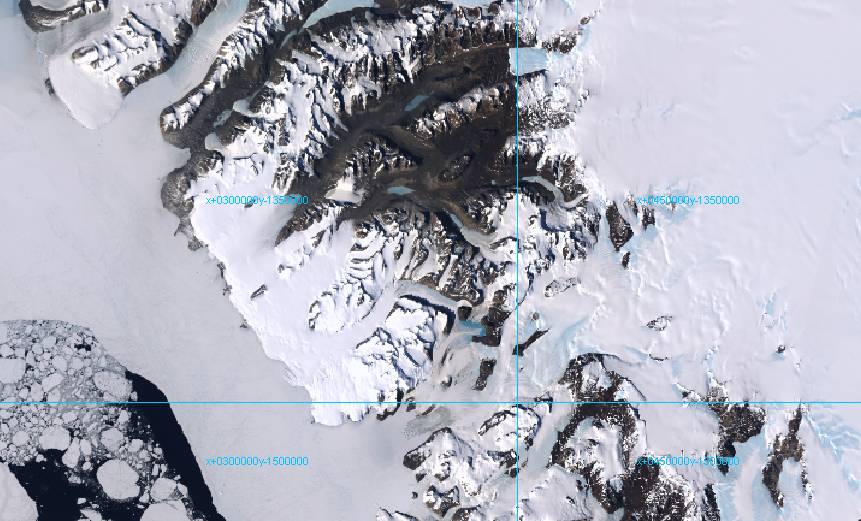
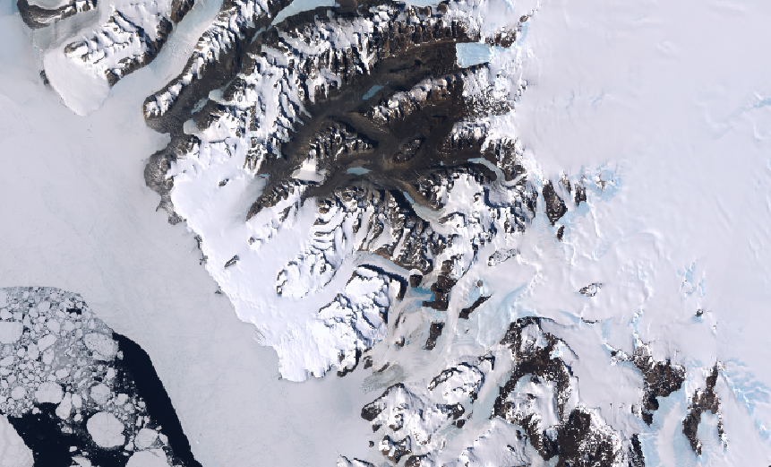
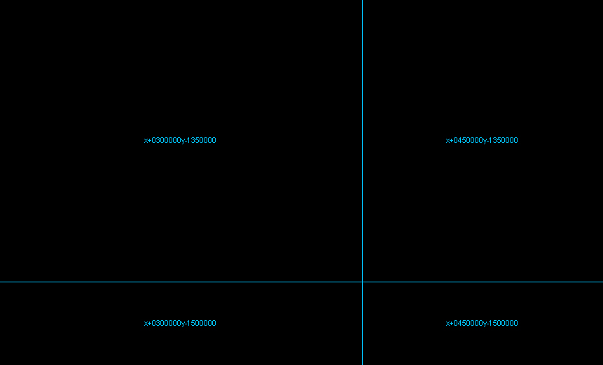
*I have included screen capture images of your area of interest that
show the image, the image with names, and the tiling scheme. These
should give you an overview of the general look and color of the image. *
*I hope this information helps you. If not, please feel free to contact
me directly with your questions.*
*Sincerely,*
*
Daniel Sechrist
[log in to unmask]
703-648-4808*
From: Jennifer E Runyon/GEOG/USGS/DOI
To: Daniel R Sechrist/RGIO/USGS/DOI@USGS
Date: 10/27/2009 04:34 PM
Subject: Fw: Map or satellite image of Victoria Land, Antarctica needed
------------------------------------------------------------------------
Hi Dan.... not sure if you're on this MAPS list or if you're able to
help them out? But only if you have time..... feel free to delete! I
was tempted to point them to GNIS & the LIMA link, but I can't determine
the currency of the imagery/maps.
Thanks.
Jenny
BGN staff
x4550
----- Forwarded by Jennifer E Runyon/GEOG/USGS/DOI on 10/27/2009 04:26
PM -----
From: Maps-L Moderator <[log in to unmask]>
To: [log in to unmask]
Date: 10/27/2009 04:18 PM
Subject: Re: Map or satellite image of Victoria Land, Antarctica needed
Sent by: "Maps, Air Photo & GIS Forum" <[log in to unmask]>
------------------------------------------------------------------------
------- Original Message --------
Subject: RE: Map or satellite image of Victoria Land, Antarctica
needed
Date: Tue, 27 Oct 2009 19:32:32 -0000
From: Francis Herbert <[log in to unmask]>
To: <[log in to unmask]>
Have you enquired of BAS [=British Antarctic Survey] in Cambridge
(England) and/or Nigel Press Associates (England)?
Francis Herbert
-----Original Message-----
From: Maps, Air Photo & GIS Forum [mailto:[log in to unmask]] On
Behalf Of Maps-L Moderator
Sent: 27 October 2009 16:28
To: [log in to unmask]
Subject: Map or satellite image of Victoria Land, Antarctica needed
-------- Original Message --------
Subject: Can you pose a ? for me to maps-l
Date: Tue, 27 Oct 2009 11:08:10 -0500
From: Susan Peschel <[log in to unmask]>
To: Maps-L
We have a patron interested in a current (post 2005) topographic map or
detailed satellite image showing the area of Mt Swinford and the Ringer
Glacier in Victoria Land, Antarctica. Can anyone suggest a source for
this?
Thanks.
Susan
|


