Hi Sue,
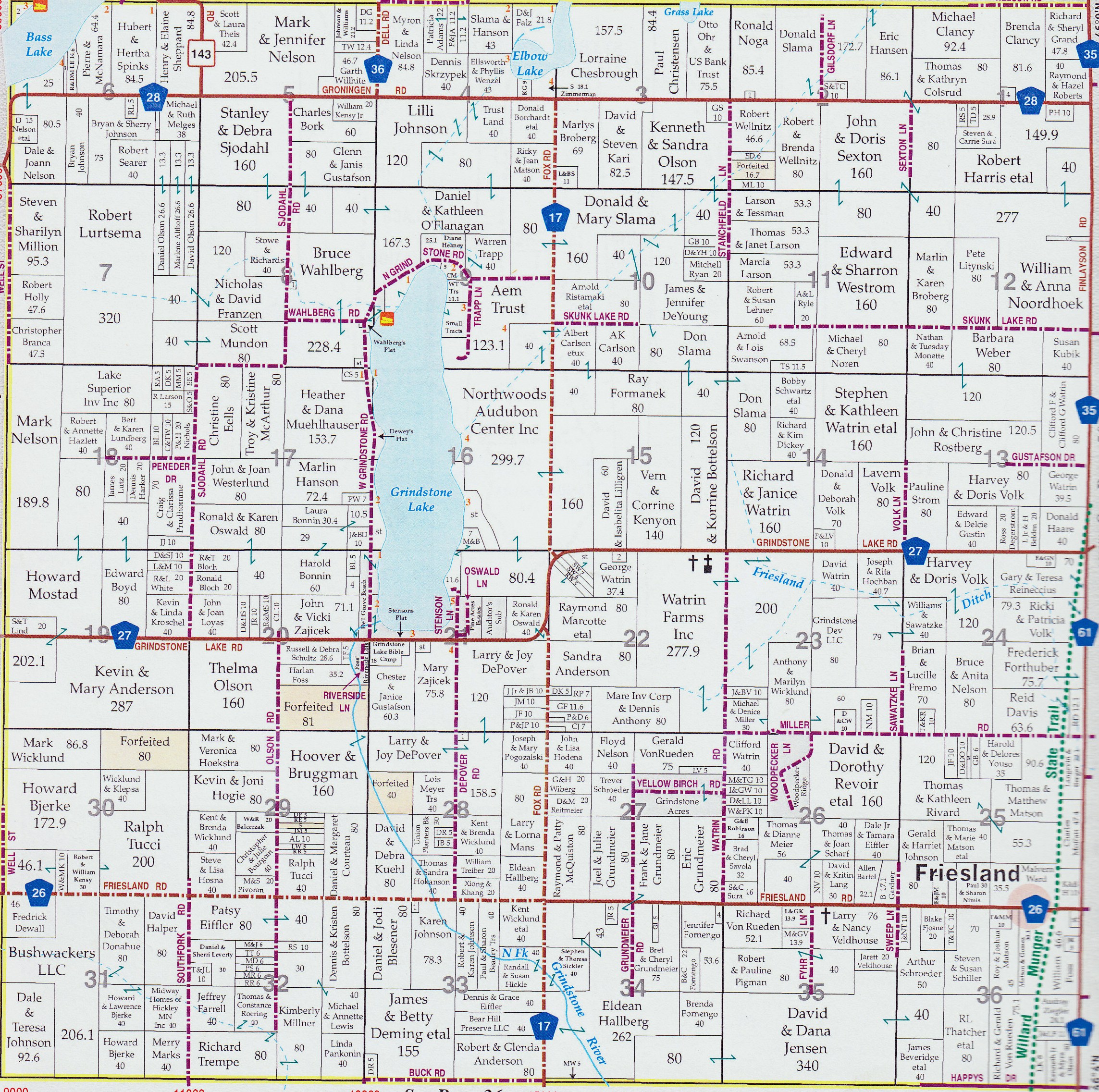
County plat maps are the property ownership or cadastral maps. There is a pretty good description at wikipedia
http://en.wikipedia.org/wiki/Plat
and here is a decent modernish example:
http://www.dellgrovetownship.com/images/Dell_Grove_Plat_Color_1.jpg
Angie
Athentic, Inc of LaPorte, Indiana has gone out of business. They still have some stock to sell off.
If you collect county plat books of Indiana or Michigan, you could give them a call and see what they still have. They’re very cheap – only $20 each.
219-362-8508
Kathleen Weessies
Geosciences Librarian; Head, Map Library
Michigan State University
Main Library
366 W. Circle Drive, W308
East Lansing, MI 48824
517-884-0849