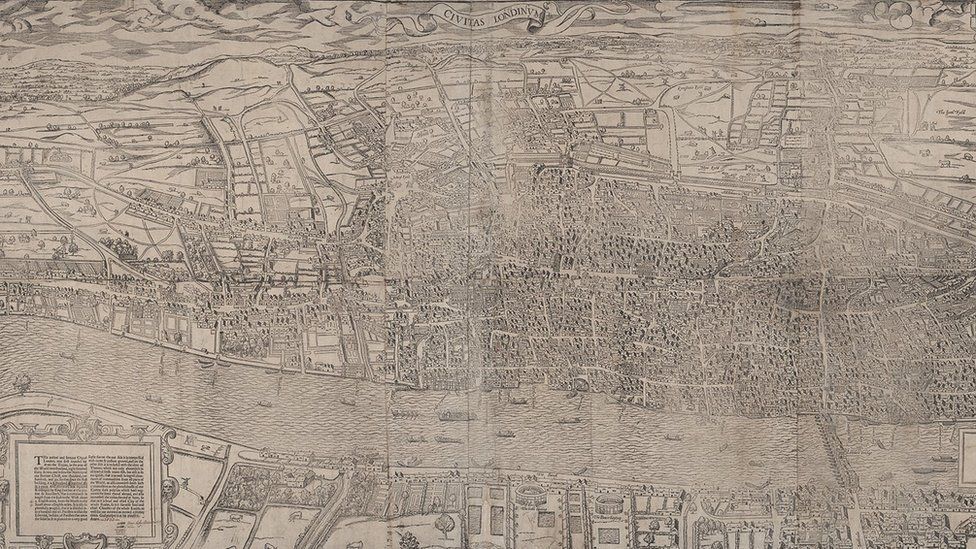
The oldest surviving complete map of London is to go on display as part of a new exhibition.
Civitas Londinium was created in the 1570s and gives a view across the capital, from the bear-baiting pits of Southwark to the fields of Highgate.
Other maps to feature include a survey of the damage caused by the Great Fire of London and ones highlighting the spread of disease in Victorian times.
They will all form part of a display at the London Metropolitan Archives.
-