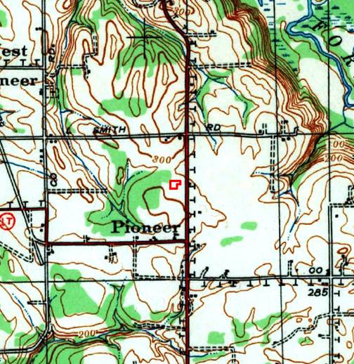
Thank you all for your help and the links!


[cid:image002.jpg@01D2F71A.D4FBAE40]<http://www.historicalinfo.com/fimo/>   [seemoreincolor]


David Hodnefield

President

[log in to unmask]<mailto:[log in to unmask]>

952-253-2004 ext 111


Historical Information Gatherers (HIG)

www.historicalinfo.com/fimo/<http://www.historicalinfo.com/fimo/>

[LinkedIn-Logo-02]<https://www.linkedin.com/organization/2985404>[facebook icon]<https://www.facebook.com/search/top/?q=historical%20information%20gatherers%20-%20hig>[twitter icon]<https://twitter.com/HistoricalInfo1>[youtube icon]<https://www.youtube.com/playlist?list=PLftxFDJe-tuucvIyAujnPQa7mKcddUAED>


From: Maps-L: Map Librarians, etc. [mailto:[log in to unmask]] On Behalf Of Stanley D Stevens

Sent: Monday, January 20, 2020 10:32 PM

To: [log in to unmask]

Subject: Re: USGS Topo Help


That is the symbol for a telephone line.


Stanley D. Stevens

Librarian Emeritus

UC Santa Cruz


On Mon, Jan 20, 2020 at 8:04 PM David Hodnefield <[log in to unmask]<mailto:[log in to unmask]>> wrote:

Howdy folks.


I have a client who is trying to figure out what the symbol “T” means on a USGS topographic map (see below).  The map is from 1940 and I don’t see any interpretation of it on the USGS key of symbols (https://pubs.usgs.gov/gip/TopographicMapSymbols/topomapsymbols.pdf).  My suspicion is a transmission or telephone line, but that’s only a guess.  Thanks for your help.

[cid:image001.jpg@01D5CFBA.0C471770]


[cid:image002.jpg@01D2F71A.D4FBAE40]<http://www.historicalinfo.com/fimo/>   [seemoreincolor]


David Hodnefield

President

[log in to unmask]<mailto:[log in to unmask]>

952-253-2004 ext 111


Historical Information Gatherers (HIG)

www.historicalinfo.com/fimo/<http://www.historicalinfo.com/fimo/>

[LinkedIn-Logo-02]<https://www.linkedin.com/organization/2985404>[facebook icon]<https://www.facebook.com/search/top/?q=historical%20information%20gatherers%20-%20hig>[twitter icon]<https://twitter.com/HistoricalInfo1>[youtube icon]<https://www.youtube.com/playlist?list=PLftxFDJe-tuucvIyAujnPQa7mKcddUAED>


