Brendan,
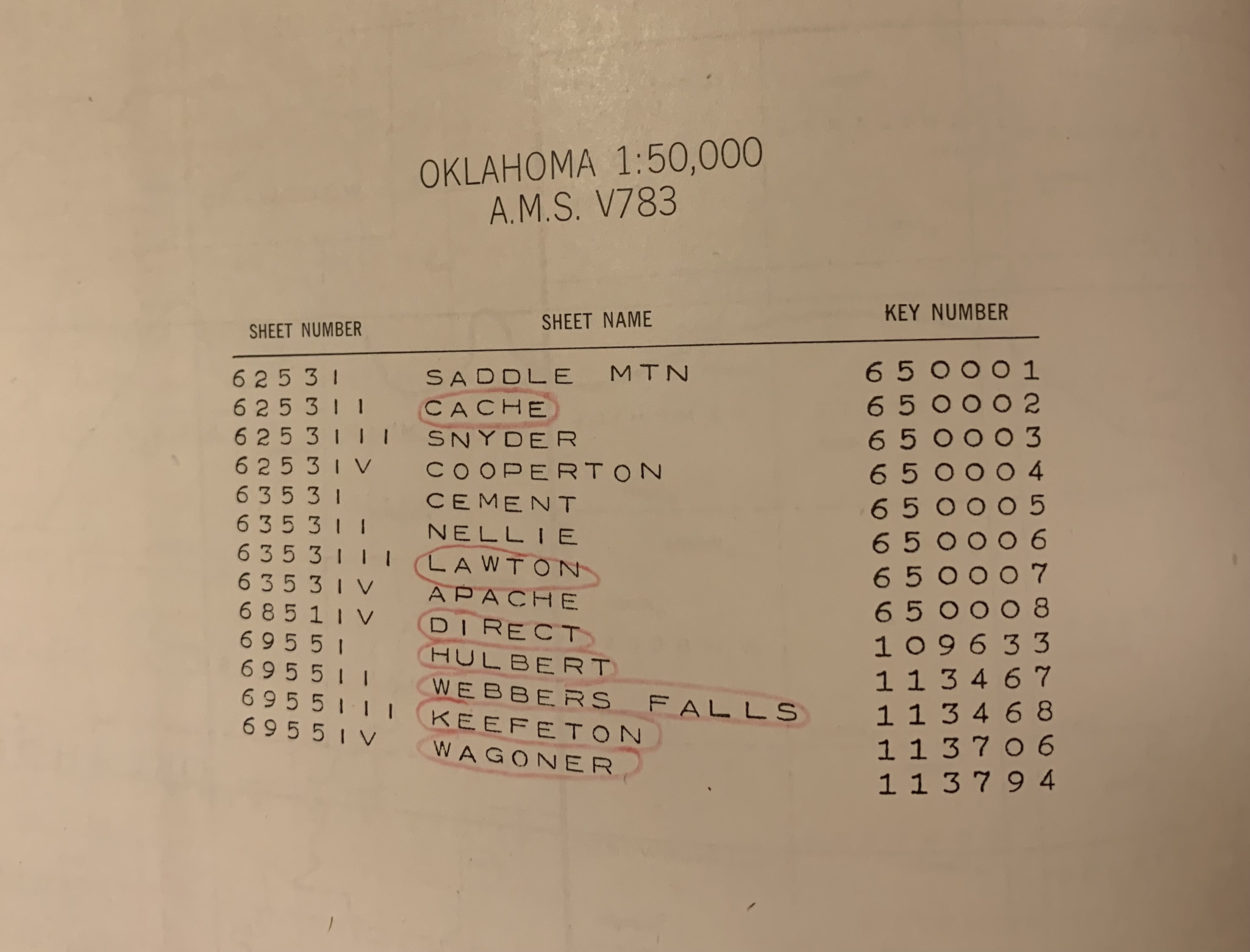
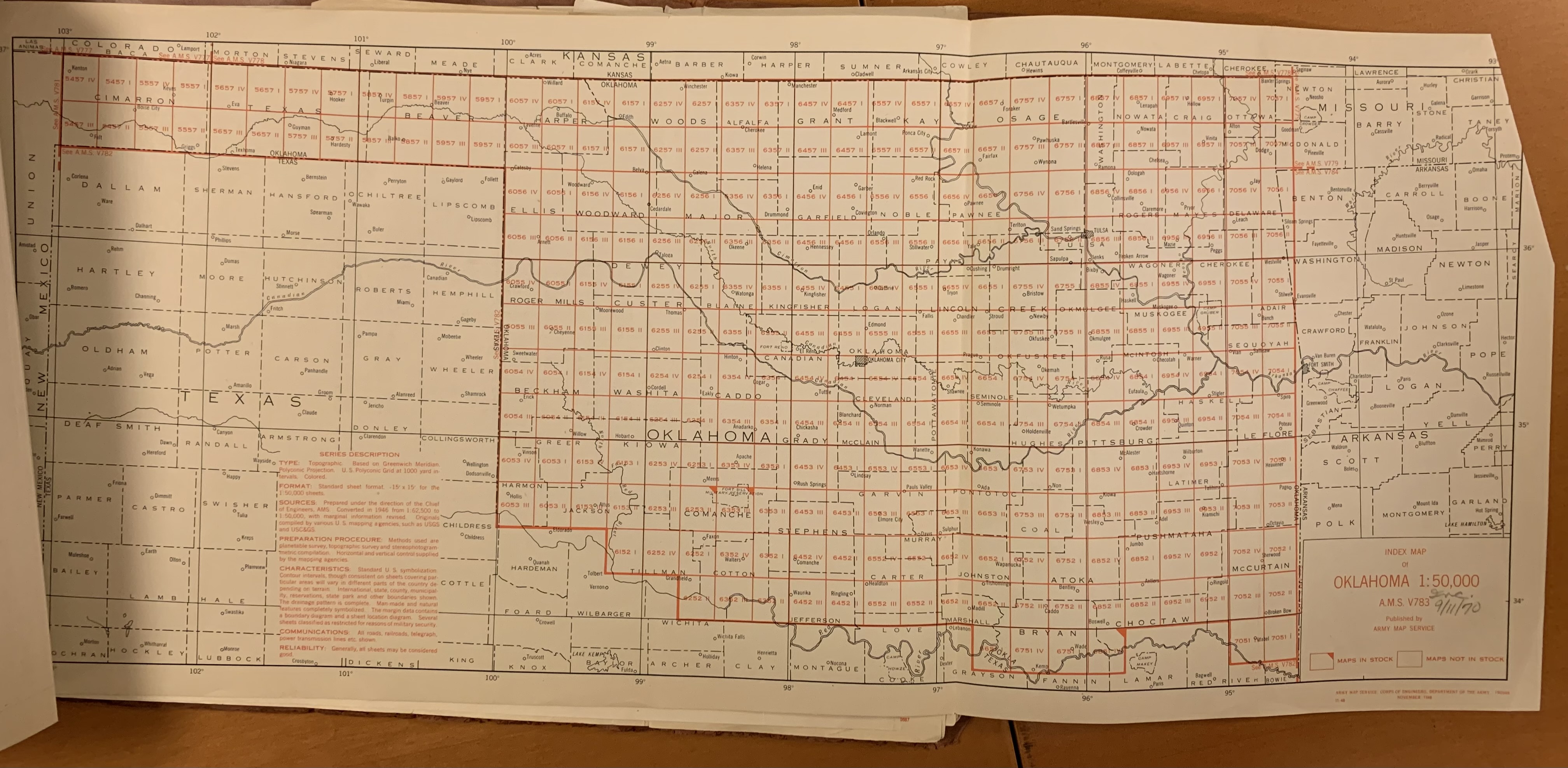
We have the index map, but as you can see there aren't many sheets listed
on the back so maybe not much more than you have already?
Craig
Craig Haggit
Map and Geospatial Librarian, Special Collections and Archives
Denver Public Library
10 West 14th Ave. Parkway
Denver, CO 80204
720-865-1813
[log in to unmask]
*Let's be social! ** <http://www.facebook.com/WHGnews/>
<http://www.instagram.com/dplvintage/?hl=en>
<http://twitter.com/whgnews?lang=en>*
On Tue, Mar 5, 2024 at 6:01 AM Brendan Whyte <[log in to unmask]> wrote:
> Does anyone have and index for, or know the extent of published sheets for
> AMS series V783 Oklahoma 1:50,000?
>
> We have 2 sheets (Lawton & Cache, both printed 1978) , covering parts of
> Fort Sill Military Reservation. but how many more are there? One or two,
> or full state coverage?
>
> Thanks for any help!
>
> Brendan Whyte
> National Library of Australia
>


